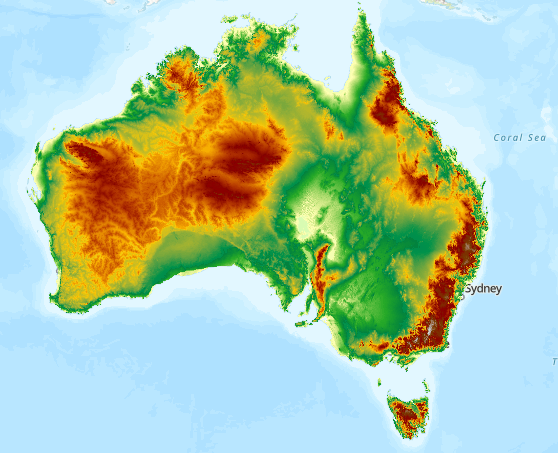
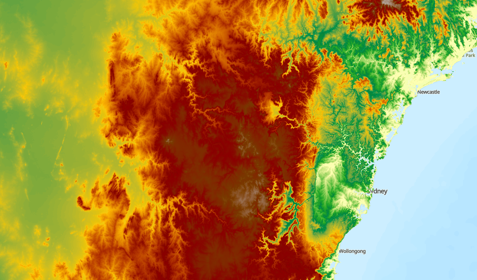
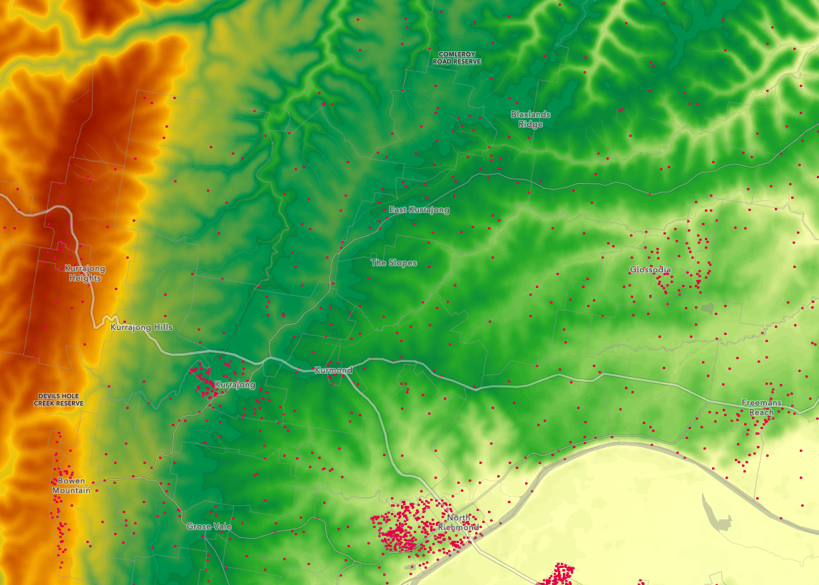
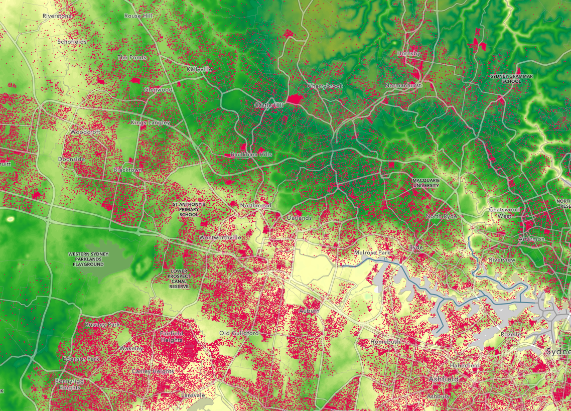
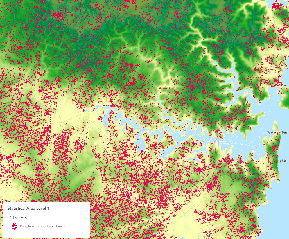
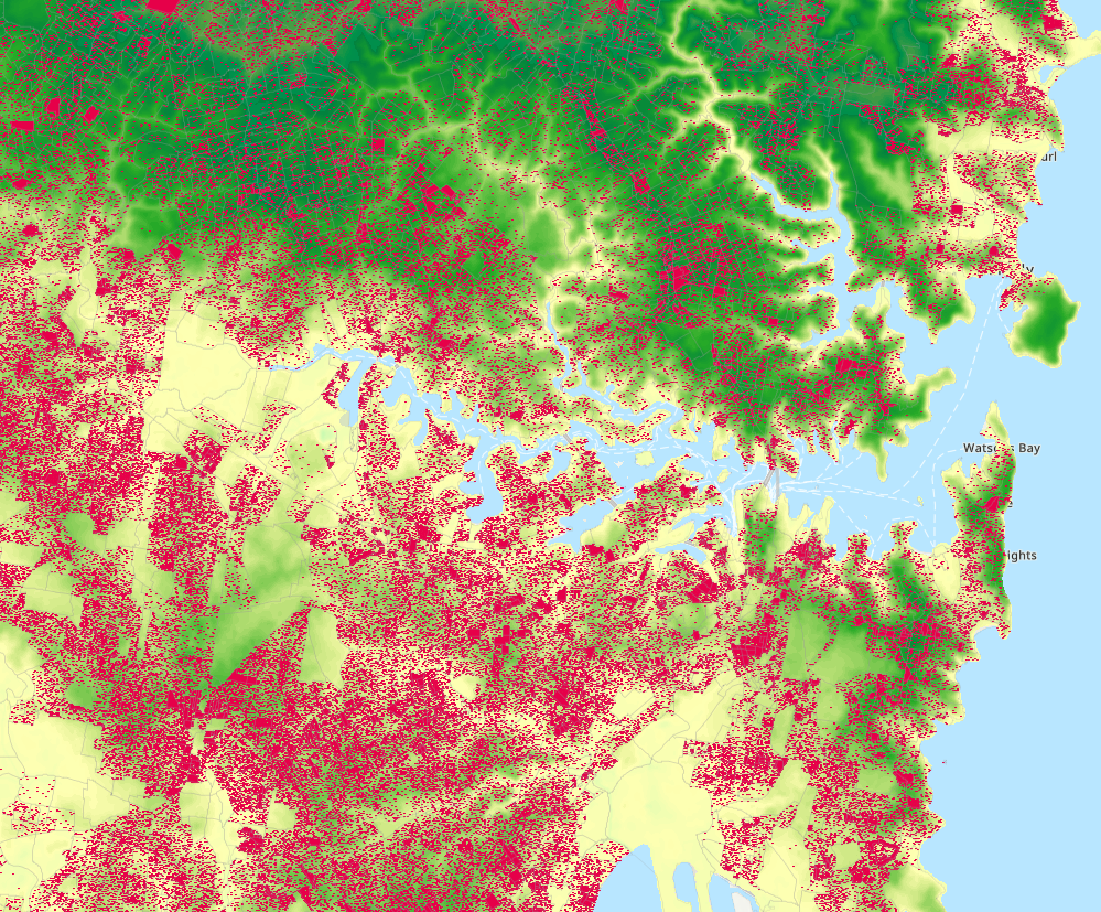
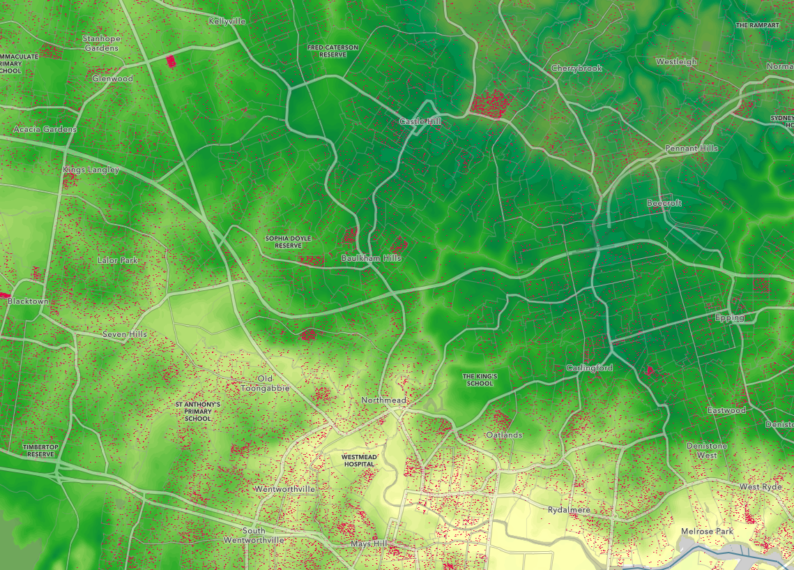
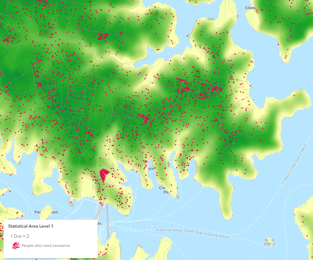
This project utilises Esri's web-based mapping software ArcGIS Online and DEM data from Geoscience Australia to construct a visualisation that integrates Australian Census data onto a single map. The objective is to provide a comprehensive understanding of population distribution. Additionally, the project seeks to overlay Digital Elevation Model (DEM) data to highlight vulnerable populations residing in flood-prone regions.
The primary benefit of this visualisation is its ability to identify areas with heightened susceptibility to flooding, a crucial aspect of strategic planning and risk mitigation efforts. By offering valuable insights into the spatial distribution of people, it provides a comprehensive understanding of population vulnerability.